Millions of years of building canyons, ridges and rims
Article and photos
by Carol Godwin, Cycle Mania
We just returned from helping at NPC’s “Pedal The Petrified” and being there made me realize a few important things. One is that people are generally good and want to help where they can. These hundreds of cyclists who showed up in this hard-to-reach far north region of Arizona, weren’t there to get a prize of any sort, weren’t there to gain fame or benefit their companies, weren’t there to beat out the next guy or to do anything but enjoy riding their bikes in one of the most beautiful and unique places on planet Earth for the benefit of young students trying to make their lives better via education.
No age categories, gender categories, race categories, citizen/non-citizen categories, weight categories, political categories, or bike type categories existed. Among the crowd were individuals in spandex, some with potbellies and others with sleek, muscled physiques. Two older women spent the night sleeping in their cars to make it, and a guy from Chicago flew over, rented a bike in Sedona, and cycled here just to take part! There were kids, there were competitive road-bikers, and there was a veteran in his 90s on an e-tricycle boasting a U.S. flag, but most of the riders were just normal folks out on a spectacular Saturday. There were $15,000 carbon race machines, there were chunky e-bikes, and there were $10 thrift store cruisers, and nobody cared who was riding what. No starting pistol or jostling for a place near the front. Just an orderly mass exodus of eager people supporting a great cause, happy to get to enjoy a day admiring the geology of a place exponentially older than the very existence of the human species. (Put this event on your calendar for next year — it’s worth the drive)
How lucky are we that in Arizona, we have frequent chances to see the earth unzipped; many times all the way back to when only single-celled cyanobacteria existed? The lowest reaches of the Grand Canyon boast some of the oldest exposed rock on Earth…back to 2.1 billion years ago when the first eukaryotic cells were just beginning to start their symbiotic existence, utilizing the basic cellular machinery we still depend on today!
Erosion has built the Painted Desert mounds from alternating layers of bentonite clay mud, silt, and ashfall dating back about 250 million years, providing evidence of the last North American inland sea that supported a wide range of life forms, including the Phytosaurs, whose fossils we find in the Saint Johns’ Blue Hills area.
Tectonic forces began forcing the uplift of the Colorado plateau beginning about 60 million years ago, and, as land was forced upwards, this sea drained southwards across the landscape, creating swampy flatlands capable of supporting the massive trees and dinosaurs which eventually ended up as the incredible array of petrified wood and other fossils visible in the associated Petrified Forest. The uplift of the Colorado Plateau changed the landscape of the White Mountains’ area from being mostly covered in a tropical low-lying inland sea to being an arid desert in the north and high volcanic peaks all the way to the Mogollon Rim. This tectonic uplift is also the main force which allowed draining water to create the Grand Canyon; the Colorado river rapidly cutting through the many layers of sedimentary rock as the land rose around it, with the uplift and canyon formation finishing about six million years ago — a blink of an eye in geologic time.
Over the time span between 2 million and 50,000 years ago, the Springerville volcanic field was an interesting and short footnote, ending around the time the latest ice age began receding and the local woolly mammoths and giant ground sloths went extinct because of warming temperatures. The volcanic activity in the White Mountains’ area is also because of the active tectonic forces that created the rest of our incredible geology; Over 400 volcanoes and lava vents spewed basalt rock out of a slowly moving crack in the crust caused by the uplift as the continent was pushed southwest into the Pacific plate. The magma could seep through this weak crustal area known as the Jemez Lineament, and released volcanic pressure through the crust in a northeast direction basically from Show Low, across our current White Mountains’ landscape, through New Mexico’s Malpais National Monument and all the way to what is now Colorado, its reign of volcanic terror ended by continental crust too thick and uncracked to melt through — for now!
Now, how does this all apply to us, the local hikers, equestrians, and cyclists enjoying our White Mountain trails, you ask? Well, hold on to your helmets, it’s pretty incredible. For almost a decade now, I’ve had the privilege of getting to meet visitors to the White Mountains who come into our shop and ask about our trails. As an unofficial welcome ambassador to our amazing White Mountains, I’ve been telling people that they have two choices: river cobble and sand or volcanic basalt and dirt/mud. Do they want “friendly” smooth rocks to fall on or sharp basalt?
Ever notice that the dividing line between these two extremes is Show Low itself, specifically Show Low Bluff? I have, and I wondered why, but only began piecing it together recently as I thought about this article. Everything West of ShowLow, including the awesome Buena Vista system, Los Caballos (currently in renovation and development), Chihuahua connector, etc. runs through sandstone, sand, limestone, petrified wood and rocky cobble, while everything East of Show Low runs through basalt-based rock, from embedded chunky basalt to lose cinders. So why is this?
The location of Show Low marks the edge of the Springerville Volcanic field, with Show Low Bluff forming the westernmost boundary of the oozing basalt caprock that supports the rest of the White Mountains and the land extending toward Albuquerque. This basalt covered over the earlier sedimentary rock that dominates the land northward to the Petrified Forest, Painted Desert, and beyond into Utah and Colorado. A surprising and interesting route brought the large cobble that plagues our trails west of Show Low here. Prior to the uplift about 30 million years ago, the land we now know as home was actually lower than the southern half of Arizona and there was a massive river running northwest across the southwestern United States, bringing conglomerate rock, rounded by the pounding water, from the southern mountains, across the terrain beneath and west of Show Low. This river curved westward and eventually formed the beginnings of the current Colorado River and the subsequent Grand Canyon.
After the uplift event, the two halves of the state essentially switched elevations, causing the water to flow from north to south, and the slowly receding waters of the inland sea joined this flow millions of years ago as the land uplifted, leaving the dense metamorphic cobble in place. As you approach the rim, you see that the exposed limestone and associated marine fossil beds contain a virtual time capsule snapshot of the life in the inland sea which covered much of Arizona repeatedly as the water filled and retreated with the restless continental tectonic pressures.
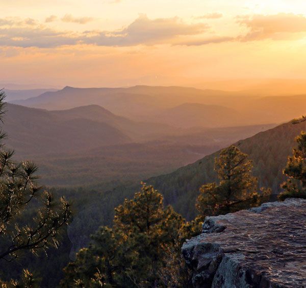
If you hike up Show Low bluff, and look westward and backwards through time, you can see the remains of the shallow sea that covered the southwest United States and the remnants of the massive river that flowed northwards across the continent, now exposed from the massive runoff draining this sea as the ground heaved upwards. Something I didn’t know until doing this research is that this shallow sea was the final permutation of all North American inland seas, draining as the continent settled into its current geologic position on the globe. When you turn eastwards, you can see many of the hundreds of cinder cone volcanoes that dominated the landscape as they burned through the uplifting and fragile crust, all the way to Escudilla Mountain and Mount Baldy, which in their heyday, were likely over 14,000’ and the dominant stratovolcanos in the landscape, erupting repeatedly for about 30 million years before the rest of the Springerville volcanic field became active.
The glaciers of the last ice age wore away much of the softer rock linked to these older volcanoes, and most of the features used by Sunrise Ski Resort are cuts formed by retreating glaciers that once covered these peaks. The rocky scree you see on these slopes is actually glacial till left from at least nine alpine glaciers hundreds of feet thick sliding downhill. Just 10,000 years ago, the last of these glaciers melted while early native hunters were stalking woolly mammoths, mastodons, and giant bison with stone-tipped spears. Imagine that!
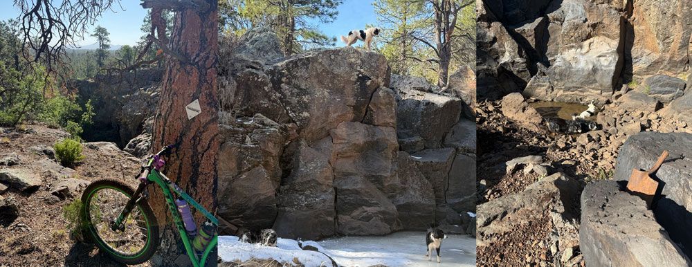
It’s interesting to remember that when you are riding the volcanic basalt of Panorama, you are riding on a thick layer of basalt caprock, above the same layers of sandstone and limestone that make up the rest of the Mogollon Rim. If you ride the Land of Pioneers (LOP), you can get a glimpse of the thickness of this capstone rock through massive basalt cracks, creating box canyons with vertical walls. Wolf Mountain, just south of LOP, boasts a visible lava dome that is over 900 feet of solid basalt. The cinder cones that erupted through, and on top of this caprock give us the hills you climb up and around on Los Burros: Wishbone mountain, Lake Mountain and the rest — 405 documented volcanoes were active at roughly the same geologic time period, over a mere two million years; the third largest volcanic field in the continental US. The Colorado Plateau uplift, drainage of the seas, and volcanic activity with its associated release of gases must have caused massive ecosystem disruption, and I can’t imagine there was much in the way of life here.
Climb to the top of one of these massive cinder cones and take a break to just sit and imagine the geology you are sitting on. You are on top of a pile of exploded cinders in layers hundreds of feet thick, on top of capstone basalt, on top of sandstone and limestone and layers of fossils telling the story of life across time, on top of — all the way down to the mantle. All around you, throughout time, there were ancient inland seas containing enormous prehistoric creatures, towering trees, flowing thick basalt and violently exploding cinder cones, massive glaciers and woolly beasts; all capped off for us, in this sliver in time, with aspens and pines, wolves and ospreys, snowcapped peaks and bugling elk. What a great story to experience in one awesome area we call home.
Have a great time out there and remember that as each season ends, a new one comes in to replace it. Another lesson learned from nature: it is all permanent instability, subject to change. Whatever is happening geologically at one point in time will certainly change at another point, and the associated life will change and adapt with it. Marine reptiles living in an inland sea were replaced by antelope and sagebrush, and the early hunters stalking mammoths on glacier edges could never have imagined that the glaciers would melt and be replaced by riders on downhill mountain bikes! Whatever may happen with bark beetles, and drought, and data centers really doesn’t matter in the long run, as layers of rock will also eventually cover these things over as the tectonic forces continue to force change on an unsuspecting landscape. There is something comforting in knowing that nature will continue building the story of the Earth, and life will find a way no matter what changes this brings to human beings.
And…bring on that Super El Nino! I want snow-covered volcanoes and a chance to use my snowshoes and fatbike this year. A glacier or two on Baldy would be cool too, in more ways than one! Who doesn’t want to see a mastodon lumbering through Pinetop or a sabertooth tiger dumping over trash cans on a Tuesday night? Stay safe out there and remember to appreciate the little things along the trail that remind us that life is awesome!