Our changing weather and what it means
By Carol Godwin, Cycle Mania
El Nino, amospheric river, hurricanes, unprecedented weather, colder than normal, warmer than normal, drier, wetter…tornadoes touching down in Arizona, drought-induced bark-beetle kills, 100-year floodplains and a record 171 severe thunderstorm warnings in Az just in October alone. What in the world is happening with this weather? I can’t even pretend to know since every projection map seems to predict something else. That blue or red blob showing precipitation or temperature anomalies seems to creep further west, further east, further south or…further north. Do we prepare for flooding or snow? Will we be wearing shorts in December or down jackets? Do we prepare for no electricity or no water…or all of the above? My best advice is to prepare for all and any scenario and be glad to be over-prepared rather than under. It actually sounds pretty darn awesome to be snowbound with a forced-pause button pushed this winter. A wood stove filled, a few great books to read, and some CDs to play great music: we all deserve a well-deserved break from it all.
Regardless of what might actually happen, it’s always interesting to unravel what might be going on science-wise to be causing all this weather chaos, and I’ve been trying to make sense of all the varying information provided. First, we need to recognise that nature connects everything and multiple causes produce each effect. The natural world on Earth divides into four main spheres, each both independent of and dependent on the others. The geosphere is the portion of the Earth containing the physical structure of the Earth. The rocky crust, the active magma-filled mantle, the molten outer core and solid inner core all work in concert to keep our living Earth warm and constantly changing. Vertical rivers of hot magma rise within the mantle due to density gradients, and this builds up tremendous pressure, which must be periodically released through volcanic vents and tectonic plates continuously moving and adjusting. The geosphere contains the fossilized carbon remains of previously existing life on earth and humans have been extracting these ancient carbon deposits as an important energy source for over a century, releasing this carbon into the atmosphere at a much greater rate than it is being stored, causing an unbalance in the percentage of carbon present in our atmosphere, the third sphere in play in our story of the Earth’s weather.
The second sphere, the hydrosphere, involves all the water on Earth and includes enormous, but currently unusable, reserves of water embedded deep in the rocks of the upper mantle. Water exposed on Earth includes both the salt water in the oceans and the fresh water stored in aquifers within the continental plates and in lakes and rivers. Aquifers have come to the forefront of attention worldwide, as humans are removing this water at a much greater rate than it is being replenished and freshwater shortages are a looming threat to humanity’s long-term continued survival. Water in the oceans travels in currents driven by density gradients because of water temperatures. Water at the equator heats at a greater rate than water at the poles, and until it freezes, cold water is denser than warm water. This temperature differential creates vast intra- and inter-ocean rivers called currents. These currents are mostly predictable, and sailors have used these currents to navigate the oceans for centuries. Water is a unique substance as it is one of the very few substances that has the property that the solid form is less dense than its liquid form and therefore floats in its own liquid. Floating ice creates an insulating buffer for the liquid water below and allows life to continue flourishing in the cold temperatures of the poles. As a whole, water is resistant to thermal changes, and having 70% of the Earth’s surface covered in liquid water is a buffer against drastic temperature changes on Earth.
The third sphere involved in our weather story is the atmosphere, again a sphere layered by density gradients and constantly on the move. Science considers both gases and liquids to be fluids, and the similarities between the oceans and our atmosphere are interesting. It is helpful to think of our atmosphere as being a gaseous ocean that we live in at the bottom of. Clouds are water vapor floating at the top of the troposphere, and the flattened tops of towering cumulus thunderclouds show us the dividing line between the upper reaches of the troposphere and the flat division into the stratosphere. Atmospheric rivers follow the path of least resistance, and these rivers of air carry clouds and storm tracks in predictable patterns similar to the ocean currents in the hydrosphere. Interestingly, the troposphere is only about eight km deep at the poles and over twice as deep over the equator because air expands when warm and contracts when cold. This height differential has an interesting impact on how clouds form, and to what height water vapor can rise before condensing.
All three spheres are influenced by density gradients, temperature gradients and the residual rotational effect from the Earth spinning on its axis. The Galaxy is spinning in space, the solar system is spinning within the galaxy, the Earth is spinning within the solar system, the outer core spins around the inner core and the spheres each have their own movements remnant of the formation of the planetary disk. The surface ocean currents spin in wind-driven gyres, which turn clockwise in the northern hemisphere and counterclockwise in the southern hemisphere. At the equator, the currents flow from east to west before being pulled towards the poles. The deep ocean currents are density driven and form a continuous “conveyer belt” of deep colder water from the poles, pushing aside warmer water from the equator, which is then pushed towards the poles on a 1000 year long round trip. In the atmosphere, the currents are called winds, and function similarly to the ocean currents in that they rotate clockwise in the Northern Hemisphere and counterclockwise in the Southern Hemisphere. Bands of convection cells, created by rising hot air near the equator and sinking colder air closer to the poles, continuously stir the atmosphere.
If we think of these spheres as being in a Venn diagram, we can imagine that the intersection between the geosphere and hydrosphere is where erosion occurs along lines of least resistance. Water flows downhill and follows and enlarges weak or depressed areas of the crust. The intersection of the hydrosphere and the atmosphere is where we find weather, and the intersection of the atmosphere and the geosphere is where we find the topography of the land, altering atmospheric patterns and bringing us rainfall. The intersection of all three spheres is a fourth sphere called the biosphere, which includes all of where we find life on Earth from the deepest ocean vents to the highest bacteria and fungi found floating in the atmosphere. Why does all this matter to us? Even though we account for only a small fraction of a percentage of life on Earth, we have a profound impact on the biosphere, the thin film of humanly habitable space on our planet and this impacts all of us in important and potentially life altering ways. We have all heard about global climate change/global warming, etc. but how can we understand how our interactions impact the structure of the biosphere? And what does this have to do with us right now and into the future? What does this have to do with the drought, and tornadoes and flooding we have experienced here just this past year, and what can we expect this upcoming winter?
As I understand it, because humans have been removing previously unavailable fossil carbon from the geosphere and adding it to the atmosphere at an accelerated rate far beyond what plants and other organisms can process, this carbon is creating an insulating layer within the atmosphere. Solar radiation from the sun, which penetrates this layer, is basically trapped under the thick troposphere of the equator and has been slowly super-heating the underlying oceans of the hydrosphere for a century. This warm bubble of water at the equator is referred to as El Nino because the timing of its resultant effects usually occurs in late December around Christmas. The strength found in the +4-7ºF surface and +18ºF subsurface temperature differentials of this year’s bubble is unprecedented in human history, surpassed only by the Permian extinction event 250 million years ago when ocean temps increased by 40ºF because of a massive transfer of carbon dioxide from the geosphere to the hydrosphere caused by volcanic activity. This ocean warming caused over 96% of all marine species and 70% of terrestrial species on Earth to go extinct and took several million years for the oceans to cool, allowing life to rebuild and recover. Eek! Those of you paying attention to numbers…there is a substantial reason to do what we can to curtail carbon dioxide release and slow global/ocean warming!
Because water is resistant to thermal change, this heat has been slowly building at the equator for decades and is trapped in the equatorial currents moving slowly at the equator. Warm water is less dense and has higher molecular movement than cooler ocean water and is more likely to evaporate into the atmosphere. Fresh water evaporates, leaving denser salty water behind, which subsequently sinks into the deep ocean. When the ocean warms significantly in an area, a phenomenon called atmospheric coupling happens, and the warmth of the El Nino adds energy to the oceanic and atmospheric currents and creates clockwise hurricanes in the northern hemisphere and counter-clockwise typhoons in the southern hemisphere. The water vapor rising in the thick troposphere above the equator condenses into clouds as it cools and creates interior currents that continue to feed the storm. As the storm tracks north or south, it is compressed against the stratosphere by the thinning troposphere layer and develops the classic flat-topped clouds with corresponding increasing circular winds found in hurricanes and typhoons. When the storm makes landfall, it is forced upward as it encounters continental air masses and rapidly cools, with cooler air being less able to contain water vapor, rain is released. As the storm disintegrates, it follows the path of least resistance as an atmospheric river which can be hundreds of miles wide and thousands of miles long, moving trillions of gallons of fresh water from the ocean to the land, leaving the salt behind in the ocean. This atmospheric river flows predictably across the landscape, dropping rain as it moves. The last storm we had involved an atmospheric river across central Arizona heading mostly northwards, intersecting Flagstaff. Similar to a terrestrial river, an atmospheric river can remain in place long after the storm passes and can draw in repeated storms along the same path.
The flooding we experienced in the last storm was because of interactions between the hydrosphere and geosphere where the supersaturated upper ground level could no longer absorb the increased precipitation, causing runoff. I’ve had several people ask if we now can stop worrying about the dropping local water tables because of all this rain. Unfortunately for us, it takes centuries for water to percolate down to the water table, so although it’s great news that our lakes are full, no, this will not affect the water table during our lifetimes. The super-saturated ground that caused this runoff only extends down a few inches to feet, and the underlying rock and soil beneath are still as dry as they were before the storms. In fact, most of the water in the aquifers we use today came as melting ice from the last ice age tens of thousands of years ago. Kind of cool thought though…you are drinking water that a mammoth probably waded through as the glaciers were melting off of Baldy!
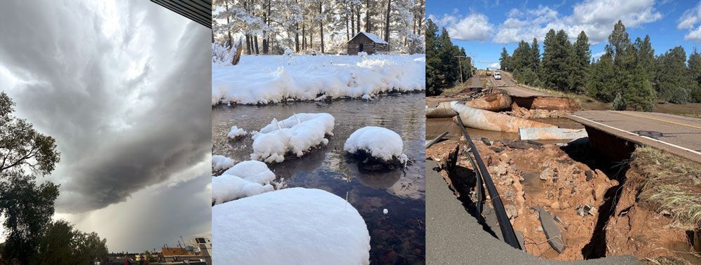
In summary, the real answer to why we went from a drought with dry lakes and dying trees to having the Bridge over Porter Creek crack apart and float on down towards Show Low Lake, is that altering the carbon content in our atmosphere by removing ancient stored carbon as fossil fuels, burning said fossils fuels, and transferring this carbon from the geosphere to the atmosphere, we are building a blanket over the oceans causing them to warm. The warming oceans are transferring this heat from the hydrosphere to the atmosphere as increased evaporation, and this is subsequently altering the paths of atmospheric movement. The change in circulation patterns in both the hydro and geo spheres is causing a change in precipitation and wind movements into unfamiliar territory, and weather “prediction” is based on experience. Because this amount of warming is unprecedented in the human timescale, it is difficult for meteorologists to predict the outcome with much confidence, thus the varying maps and prediction models. Without getting too maudlin, the main take-away from this is that if we continue to mess around with Mother Nature, things can definitely get even weirder. The Permian extinction event I mentioned earlier occurred because the oceans warmed to over 100°F; current temps in the El Nino equatorial region now average 80-84°F with a 4-7 ° F rise just this year. How’s that for a dire warning for humans to stop this runaway train now while we still have a chance? The current water temps are still building because of the lag caused by the thermal inertia of the ocean water, and if we reverse course now, the resultant change in temperature will take years if not decades to show up. Yay…science..
The prediction for this winter is that this El Nino driven atmospheric river will displace the normal East-west jet stream and cause it to shift south to run across the southern US rather than its normal northern path, bringing with it significantly wetter conditions for states below the jet stream and drier and warmer conditions for those above it. Because this is tropical moisture, it is predicted that for elevations below about 8000’, we will have about double the amount of average winter rain and wet snow, with the bulk of the precipitation occurring late Dec through Feb 2027. So…it sounds like we can expect a sloppy wet winter this year rather than the feet of fluffy snow we wanted, but we will take what we can get! Get your ski pass and be ready to travel to higher elevations to get into the real snow. Enjoy what nature brings up and remember that Arizona was once covered in a tropical inland sea with great aquatic reptiles dominating the landscape, Baldy was once covered in Alpine glaciers with wooly mammoths and giant ground sloths roaming around and there’s more to come in the future. Enjoy the ride on this amazing rock spinning through space, and stay off wet trails. See you out there.