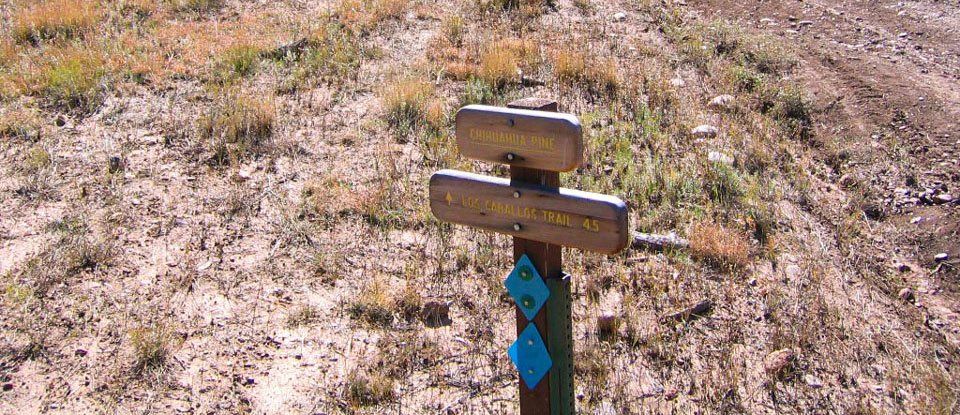
CHIHUAHUA PINES CONNECTOR TO BUENA VISTA
The connector trails are the links that tie the White Mountain Trail System together so it’s ironic to ride connector trails in sections but that’s what I’ve done. The 4.4-mile Chihuahua Pine Trail in Show Low connects the Buena Vista Trail at a junction 1.5 miles from its trailhead to the Los Caballos Trail at a junction 4 miles from its trailhead. It’s named for the fact that it traverses one of the few places where Chihuahua pines grow in the White Mountains.
One warm, sunny late October morning when the oaks were in their fall foliage, I trailered Cinnamon to the Buena Vista Trailhead. Cinnamon loaded and trailered perfectly. At the Trailhead, I finished grooming her and saddled up. We set off down the Trail about 11:45 a.m.
We rode along the Buena Vista Trail to where it skirts the edge of a pond. We left the Trail and took an ATV trace across the west side of the pond to get to a dirt road that goes behind the Summer Pines subdivision. We followed that road, then cut cross country to another road and followed it briefly, then cut cross country again and found the Chihuahua Pines Connector at marker CP16. This is not the official trail junction.
From where we joined it, the Chihuahua Pine Trail follows the edge of a canyon for about half a mile. We briefly lost the Trail and took a slight detour before finding the marked Trail descending into the canyon. The Trail uses a rectangular concrete tunnel under US Highway 60 as an underpass. ADOT installed this tunnel in the canyon for water. It just coincidentally turned out to be an acceptable trail underpass in dry weather.
Horses are instinctively wary of entering dark places where they might be trapped by a predator. US Highway 60 is wide enough so that the tunnel under it has a dark spot in the middle, though daylight is visible from the far side. I encouraged Cinnamon to walk toward the tunnel which she did hesitantly. At my coaxing, she started to enter the tunnel but then circled away. I circled her back toward the tunnel and offered more encouragement. She circled again. She almost entered the tunnel, then backed away. She repeated the circling and backing away a few more times. When Cinnamon bravely stepped one step into the tunnel, I gave her a treat. She hastily backed out again as if to say, “You’re the leader; you go first!” After more backing and circling, Cinnamon ventured one step into the tunnel again. I praised her and stopped her there. I dismounted, attached a lead rope to the halter she was wearing under her bridle and led her through the tunnel. Cinnamon walked beside me obediently, snuffing and sniffing at the darkness. Her ears flicked back and forth at the sound of her own hooves on the concrete floor. When we exited the tunnel, I rewarded Cinnamon with another treat, then mounted and we continued up the Trail.
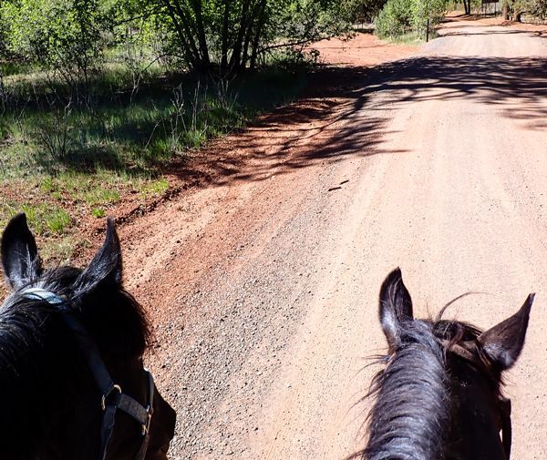
Chihuahua Pines Trail drops back into the canyon, crosses it and climbs out again before angling west across the hills. The oak trees were beautiful with their leaves all yellow, bronze and rust. There were fallen logs across the Trail in several places -- most of them too large to step over so we went around them. This section of Trail is rocky and makes some short but steep climbs. Cinnamon picked her way carefully through the rocks at a slow walk. The Trail crosses a power line right-of-way. A quarter mile later, it crosses a single-lane dirt track. About half a mile from Highway 60, the Trail follows the shoulder of a ridge where views to the north include the windmills outside Snowflake. The Trail descends the slope, dropping into the trees before crossing another trace of a dirt road.
We continued west until the Trail passed a pond at around marker CP8 -- which my GPS said was 3.7 miles from Buena Vista Trailhead. We stopped for lunch at the pond. Cinnamon sniffed at the muddy water but didn’t drink any. It didn’t look very appetizing. Cinnamon grazed while I ate my sack lunch. After lunch, I mounted Cinnamon and we started east -- back the way we’d come.
We were around marker CP12 when I realized I’d lost my camera. We turned around and went west while I scanned the ground looking for the camera. We backtracked almost half a mile before I found it. The camera survived the fall from the saddle and worked fine. We turned around and resumed going east.
Cinnamon eyed the traffic above us on Highway 60 as we approached. She hesitated briefly at the tunnel entrance. I reassured her and reminded her we’d come through it earlier. After thinking it over for a minute or so, Cinnamon obediently marched through the tunnel with me riding. I praised her as we went through and gave her a treat when we arrived safe and calm on the other side. We found the marked route out of the canyon.
This direction we followed Chihuahua Pine Trail to its official junction with the Buena Vista Trail. When we got to the Trail junction, I decided to take the Buena Vista Trail back to the trailhead. This section of Buena Vista Trail climbs up and over a hill. I took some photos of that portion of the Trail. My GPS said it was 1.75 miles back to the trailhead. We arrived about 3:10 pm. Cinnamon was tired and didn’t drink the water I’d brought for her, though she did wet her mouth with it. I took my time about unsaddling, grooming and dressing her for travel so she could rest a little before the trip home. It was a lovely ride on a gorgeous fall day in the White Mountains.
From scenic overlooks to rivers and wildlife in the White Mountains
Horseback Riding the White Mountain Trail System
Opening home and heart to love again
Kayaks and Crawdads at Big Bear Lake (Sush Be Tou)
Great-Granddaughter of Corydon Cooley
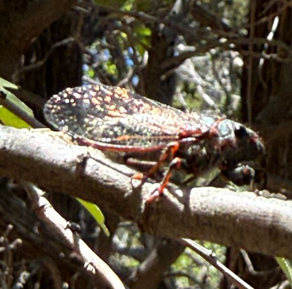
The plight of the cicada
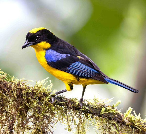
Adventures in Costa Rica part II
The stories we tell ourselves color our responses...
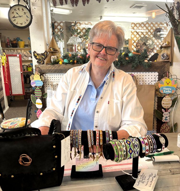
Local White Mountain Artisan and Authur
Are you the voice in your head? or something deeper...