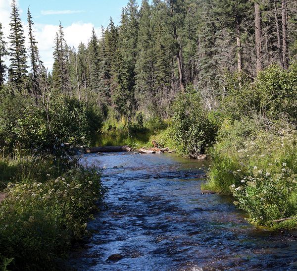
Navajo County's Search and Rescue
If you happened to be hiking in Woodland Lake Park a couple weekends ago you may have run into small groups of people, some in red uniform shirts and others with their maps, compasses and GPS close at hand. Don’t worry, it’s not the red army invading, as those folks are actually volunteer members of one of the Sheriff’s non-profit posses, Search and Rescue, Inc.
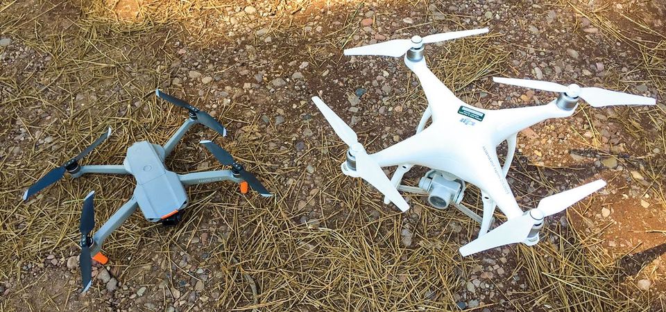
This search and rescue unit trains every month somewhere in Navajo County, moving around to different areas so team members can get familiar with the entire county. The unit has also been asked to assist with searches on the Navajo and Hopi Nations, as well as the Fort Apache Indian Reservation. One of the reasons this group is so busy is due to the variety of tools they have available. This search and rescue unit includes certified search dogs in the K-9 Unit, almost 2 dozen ground-pounders, or hikers bushwacking looking for clues, and a developing drone unit with FAA licensed and trained pilots.
You could say the ground pounding hikers are the heart and “sole'' of a search team as they are the ones called on to cover many miles in their boots looking for clues and subjects from the ground, regardless of weather conditions or time of day. Another training session was conducted at night in Woodland Park last year, just to test out everyone’s headlamps and night vision navigating. The ground pounders are assigned to a specific team to cover a specific area and report their whereabouts and any clues found to the Incident Command trailer over radio. The crew members also record their tracks on their GPS units and then download the trails onto the command trailer computer after returning.
The K-9 crew trains at least weekly to maintain their dog’s skills for certification, so being part of the K-9 team is almost like a part-time job. On top of that, all K-9 human members must first become trained and certified to be a ground pounder, which obviously includes backwoods navigation, first aid, and hiking our local terrain. Some dogs specialize in finding any lost person, smelling wafts of wind in no particular direction until they lock onto the odor of a human. These types of dogs are often called air scenters.
Others are trained to find a specific person, and are called trackers, like you see the bloodhounds on TV when they track down the escaped convicts. Obviously, this requires an article of clothing from the lost person, something that is not always available. And still other dogs specialize in the critically necessary job of locating deceased individuals when search efforts aren’t in time. The most talented dogs can do multiple jobs, but many handlers focus on one area.
The Unmanned Aerial Systems (UAS) or drone team has the same policy as the K-9 team in becoming certified as a ground pounder prior to becoming a drone pilot. This ensures that all members of the team understand the challenges and risks associated with some of their missions. Not every search can utilize UAS technology so the pilots and observers need to be ready to transition to ground pounders or assist the K-9 teams at times.
Since the Sheriff’s office is in command and directs all activities by the search team, including the K-9 and drone team, intensive training in addition to FAA certification is also conducted regularly. Drone pilots train for likely scenarios including looking for vehicles and people, as well as helping search crews cover dangerous or inaccessible areas.
Drone pilots and their visual observer have to be able to navigate to specific locations, either by a road description or sometimes a latitude and longitude coordinate. Since the quadcopter drone has to remain within visual line of sight, the pilot and visual observer try to locate themselves in a spot with the best visibility of the search area, and sometimes have to move to a different take-off and landing location.
Drones might sound like the quick and easy solution for search and rescue missions, but they have some serious limitations. Much of our area is heavily forested, preventing good visuals on the ground surface. The drones are also limited by flight times, rain, cold temperatures, winds over 15 mph, and payload weights. It is not easy to recognize people from a couple hundred feet in elevation, unless they are trying to be seen. So make sure any signal for help is easy to see if you are lost and looking for help from above.
The last training held at Woodland Lake Park did not involve the drone team since winds were gusting over 30 mph, and most of the K-9 team was out of state training. This training focused on the ground pounder skills of using a map and compass to navigate. The GPS units were used as backup as well as a portable computer to convert location coordinates of the lost subjects from the latitude and longitude system into the UTM format to make it easier to plot locations on a paper map. Phone companies and rescue aircraft use latitude and longitude coordinates but this system can be confusing as there are three different formats to display your latitude and longitude (decimal degrees: 34.872234º, -109.84732º decimal minutes: 34º 53.7213’, -109º 52.445’, or degrees, minutes and seconds: , 34º 53’ 51”, -109º , 53’ 22”). The UTM system uses only one format worldwide.
Fortunately, modern GPS units will convert these coordinates back and forth with just the press of a few buttons, into any format. The first waypoint that the posse members had to navigate to represented the location where a simulated person held down their power and volume buttons at the same time on an iPhone, automatically allowing a call to 911 with a very accurate location using the phone’s GPS. On older iPhones, (7 and before) you need to press the side button five times quickly. Android phones can have different procedures so check your phone’s help section, including setting up an SOS message with a location to your family or other emergency contacts other than 911. Otherwise, a traditional “ping” of your phone conducted by the phone company is much less accurate and can be a mile or more off. The 911 operator could not make contact with the person calling.
When the search crews navigated their way to this location from the phone GPS, they searched the area and eventually found a simulated phone and a small journal actually placed there by the training organizers. The journal had an entry describing their lunch location but the entry was interrupted by other members of the group suddenly screaming and running away. Search crews had to find the lunch location described in the journal, where their search efforts turned up a “bee hive”, cut out of foam core and colored yellow like it belonged to Winnie the Pooh.
With this clue, the search crews began to put the pieces of the training scenario together. Evidently, a group of hikers sat down for lunch when someone in the group got stung by a bee and took off running, subsequently calling 911 and then dropping their phone and journal. Eventually in this training scenario, the person stung by the bees took off running again before collapsing by one of the navigation markers placed on trees every quarter mile on the White Mountain trail system.
So the last stop for the rescue teams was finding the subject by using the numbering system on the trail system with a current map. Once the “subject” was found (for some it was a stick figure drawn on an index card!), the crews had to diagnose and treat the problem caused by the bee sting. Once the subject was “treated, stabilized, and evacuated” the search crews used their GPS units to head straight back to the Incident Command trailer parked at Mountain Mountain Recreation Area.
The training wound up with a debriefing back at the Command trailer led by Deputy Vince Palazzolo and NCSAR Captain Laurie Palazzolo. Personnel that are assigned to map locations and provide base station communications in the command trailer then downloaded the search crew’s GPS tracks to map their routes. Crews are usually asked how confident they are in searching their area, but since all crews found their clues in this training the debriefing was relatively short. Searches are usually not this quickly successful in the real world, so maps of the crews paths during one day will help with assigning search segments on the following days, if needed.
So the real search and rescue operations rarely resemble the always successful, action packed missions shown on TV. Not even the ones that are oxy-moronically titled “reality TV”! But that doesn’t minimize the time and money that these volunteers spend in getting prepared for a callout anytime, under any weather conditions, anywhere in our Navajo County. For more information on the Navajo County Search and Rescue, Inc. contact the Navajo County Sheriff's Office dispatch at (928) 524-4050 and ask for Deputy Palazzolo #1365.
From scenic overlooks to rivers and wildlife in the White Mountains
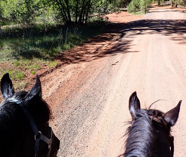
Horseback Riding the White Mountain Trail System

Opening home and heart to love again
Kayaks and Crawdads at Big Bear Lake (Sush Be Tou)

Great-Granddaughter of Corydon Cooley

The plight of the cicada
Adventures in Costa Rica part II

The stories we tell ourselves color our responses...

Local White Mountain Artisan and Authur

Are you the voice in your head? or something deeper...