Riding the White Mountain Trail System
Article & photos
by Allanna Jackson
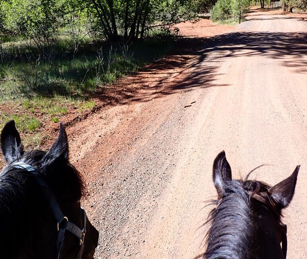
It was a warm May day with a light breeze, so I rode the Blue Ridge trail before the Memorial Day weekend crowds arrived. I hitched the trailer, loaded Cinnamon, and drove to trailhead No. 2. The trailhead was empty when we arrived, and a US Forest Service truck drove by on Forest Road 187 and waved.
We set off up the trail at 2:30 p.m. going counterclockwise ascending the numbers. We had the trail to ourselves, though we saw an OHV on the road near the trailhead. Cinnamon walked along cheerfully, looking at the scenery. Just short of white diamond marker B1 (Blue Ridge), we passed the junction with the new Lumberjack trail (LJ0). Cinnamon glanced at that trail as we passed. We continued up the Blue Ridge trail as it climbed Blue Ridge Mountain. The Gambel oak were looking fresh and green with their new leaves just sprouting. There were very few flowers on the trail however, around marker B3, Cinnamon found grass to snatch as she strolled along.
There were bicycle tracks on the trail. We found several places on the route where users had shortcut across squiggles on the trail. This is a problem because the squiggles exist to reduce erosion. When a trail offers a straight line down a slope, that’s where water flows, eroding the trail. It may seem funny to be thinking about erosion during a drought with stage II fire restrictions in effect, but the way we use a trail in dry weather influences where the water flows when it does rain or snow. Squiggles on a trail also make it easier for hikers and horses to safely ascend or descend a slope.
Cinnamon remembered this portion of the trail from last summer and cheerfully walked and snacked her way up Blue Ridge Mountain. As we approached the junction for the Lumberjack Trail near marker B9, Cinnamon looked down the trail, remembering it from last summer. This time, we continued up the Blue Ridge Trail. Just before marker B10, we passed the weathered and bullet-riddled sign identifying Blue Ridge Mountain with obscured distances to the trailheads. This sign is in a low spot between two high points. The top of Blue Ridge Mountain is about one eighth of a mile further along.
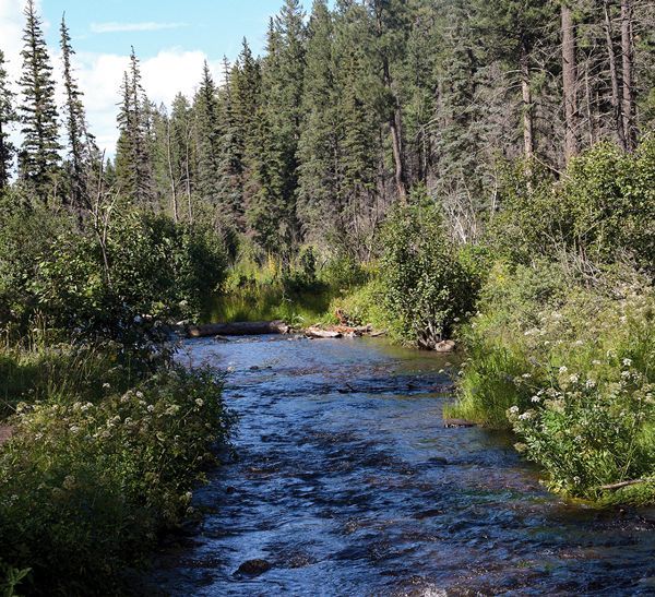
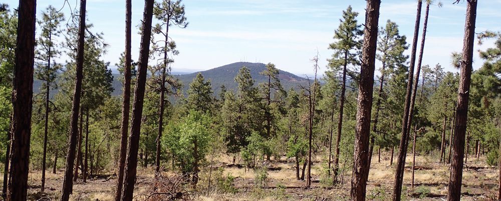
The area around the top of Blue Ridge Mountain has been thinned since the last time Cinnamon and I rode here, but there are still plenty of Ponderosa, Gambel oak and many species of juniper. Between markers B10 and B11, there is an excellent view of Porter Mountain. I also viewed the San Francisco Peaks in the distance through a slight haze.
Near marker B13, the trail descends rapidly into a denser forest with more twists, turns, and narrower spaces between the trees. The trail briefly winds around the shoulder of the mountain. Cinnamon suddenly stopped and stared at something up the slope above us. I asked her what she was watching. Her answer was a sudden spin, a quarter turn left and a skitter sideways a couple of steps. I straightened her out, and she resumed walking down the trail as if nothing had happened. Cinnamon seldom spooks, so there must have been some unusual movement out there, but I never saw whatever it was.
The trail climbs again briefly on its way to the horse gate after marker B14. Cinnamon poked the gate with her nose to see if she could open it herself, but it was latched. We stopped there while I drank some water and gave Cinnamon a horse cookie. Then I asked Cinnamon to help me open the gate. It was a complicated task, being on a slope, so Cinnamon had to duck her head away to keep the gate from hitting her. I got better control of the gate and we got through on the second try. Cinnamon helped me close the gate, and I gave her horse cookies for her work.
We continued down the trail to the junction with the Ice Cave trail after marker B15. Cinnamon has been here more than any other part of the trail because we’ve ridden to this area from home multiple times over the years. She would happily have taken the Ice Cave trail home, leaving my truck and trailer back at the Blue Ridge trailhead.
Cinnamon and I continued down the familiar switch backs. When we crossed two old roads, just before marker B18, she looked west, wondering if we were going home that way. When we crossed FR 187 to get to trailhead No. 1, near marker B19, Cinnamon looked down that road too, but we weren’t going home that way either. She slowed a little as the trail turned eastward toward Billy Creek, but resumed her three-mile-per-hour walk when I tapped her with the whip.
Some oaks in this area had not yet leafed out. After marker B20, the trail crosses underneath the power-line easement. We found an old turquoise diamond marker on a tree just after marker B21. The trail descends into Billy Creek canyon near marker B24. We could see the Billy Creek crossing and Billy Creek Connector junction just after marker B25. We met a lady hiking, and we greeted each other. The Blue Ridge Trail roughly parallels Billy Creek until marker B28, then it climbs out of the canyon under the power-line around marker B29.
The trail crosses a couple of small, dry water courses on its way back to Billy Creek Canyon, beyond marker B32, where it parallels Springs Trail and the Connector Trail between the two. As we climbed out of the canyon approaching marker B35, we spotted one wild iris blooming on the edge of the trail. I spotted some tracks of a shod horse, along with the bicycle tracks we’d been following, and Cinnamon sniffed at an old manure pile. The shod horse followed the trail for only a quarter mile or so before the tracks disappeared.
Cinnamon was getting tired, and it was past her supper time as we continued the last half mile back to the trailhead and we were the only ones there when we arrived. A few minutes later, a car drove into the parking lot and two people got out and set off hiking up the trail while I unsaddled and Cinnamon was happy to find some hay in the trailer to munch on the way home.