EYES IN THE SKIES
These days, we’re fortunate to have “eyes in the skies” providing us with views of our backyards and our outdoor hotspots through high resolution satellite photography -- in programs like Google Earth -- sometimes taken just months ago. Most folks realize we can now navigate everything from Disney Land to Mount Denali with the aid of incredibly small global positioning system (GPS) units that can track us continuously and guide us to a spot as small as a golf ball.
Today’s GPS units can store locations of important places like “honey holes” and your favorite trail overlooks or geocaches and guide you to them on color topographic or satellite photo maps. If you remember to mark or “waypoint” the trailhead or your vehicle parking spot, a GPS can get you back to safety, even in the darkest night through the worst storm. So, GPS satellite technology can save lives if we take the time to record the locations of our vehicles or important trail routes, especially in areas with no cellphone reception.
But can our artificial constellation of orbiting electronics help us at all if we can’t even figure out the first page of the GPS instruction manual? Even though the newest GPS units are designed with easy-to-use buttons on touchscreens, they have multiple layers of menu selections and cryptic titles for some buttons that can take some of the fun out of operating these gadgets. On a sunny day, small screens on GPS units can sometimes turn into a blinding mirror instead of a colorful source of important information. After a couple blasts from a screen without wearing your sunglasses, you could be using the Braille method to get yourself home. And many people who enjoy spending time in the out-of-doors to unplug and get back to basics are not necessarily into technology.
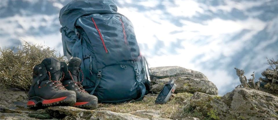
Some folks may not need all the functions of a modern GPS but still would like to have a peace of mind that they have a backup plan in case of a serious emergency. Never fear, modern technology has developed a way to use satellite communication in case of an emergency without too much pain and absolutely no artificial intelligence.
There are two different types of systems when it comes to sending an SOS for a rescue from the most remote areas using the satellites overhead. The two systems both use satellites to send an SOS signal for help and provide rescuers a rough estimate of your location but, other than that, they differ significantly.
Personal Locator Beacons (PLBs) are very simple and are used only for emergency SOS requests handled by government rescue agencies. Satellite messengers, or communicators, on the other hand, can handle 2-way communication with family and friends to update them on your position and condition but they’re also more complex and require a monthly or annual paid subscription. Both require registration with either the private company that handles the satellite messenger units or the federal government that processes the SOS requests for the PLBs.
To decide which system might best fit your needs, here are some more details on each type:
Personal Locator Beacons:
• Easy to use, with batteries that last for years
• Should only be used in emergencies where self-help is not successful
• One-way communication request for a rescue with your location - cannot cancel request
• Satellites monitored by the National Oceanic and Atmospheric Administration
• Rescue operations launched by local government search and rescue
• No messaging included - only SOS request
• No additional costs for monthly or annual subscription
Costs: $250-$500
Examples:
Personal Locator Beacons (PLBs)
ACR Electronics rescueME PLB1
MSRP: $280
Attributes: Compact, 1-handed operation, 7-year shelf life, uses GPS to provide your location
ACR Electronics ResQLink 400
MSRP: $300
Attributes:
Uses three different radios to send for help and guide rescuers to you, visual and infrared strobe lights
ACR Electronics AquaLink View
MSRP: $500
Attributes:
Buoyant, waterproof, with screen display readout of status and location, bright strobe and 35-hour operational life
Satellite Messengers or Communicators
• More complex unit requiring battery recharges depending on use
• Can record your exact route and update Face Book and Twitter accounts automatically
• Two-way, non-emergency texting with family and friends in most but not all models
• Private company monitors satellites and informs government agencies who launch rescue
• SOS request includes a precise estimate of your location - can be used for navigation
• Significant subscription costs needed to activate unit (see below)
Costs: $150-$600
Examples:
Garmin inReach Mini
MSRP: $350
Attributes: Iridium satellites provide 100% global coverage, remote tracking of your route, waypoints, pair with phone to use in areas without cell coverage, compact, rechargeable battery
Garmin inReach Explorer+
MSRP: $450
Attributes:
Compass, nice maps, altimeter, 100% global coverage, rechargeable battery, pair with phone
Garmin GPSMAP 66i
MSRP: $600
Attributes:
Best display in sunlight, great maps, cellular weather reports, full GPS, waterproof, 200-hour battery life
SPOT Gen3
MRSP: $150
Attributes:
Motion activated or interval tracking, compact, simple, 17-day battery life, replaceable AAA, send messages only - no reception of messages, no navigation features
SPOT X
MRSP: $250
Attributes:
Pairs with smartphone or can be used as standalone without cell coverage, 2-way texting, automatic tracking for family and social media, compass and waypoint navigation, small keyboard
If you have occasional cell phone service to get text messages out and are comfortable using your existing GPS for navigation, with some common sense you can certainly get by without a PLB or Messenger. For the adventurous souls out there or those who want to stay connected with the online world when outdoors, the satellite messengers are the way to go. The “peace of mind” crowd may opt more for the PLBs, which are intended to be used only in emergencies when requesting a rescue.
Unfortunately, the reasonable prices on some of the units listed above can be overshadowed by the required subscription costs to keep your unit alive and communicating with the satellites. Garmin offers some choices but the SPOT units are not as flexible. SPOT requires an activation fee of $19.99 and an annual charge of $199.99 for tracking intervals from 60-minutes to 5-minutes.
Garmin has a monthly plan but you’ll pay $5 more for the initial activation fee ($25) compared to the annual payment plan. The actual plans range in their services provided as described by their names, from “Safety” to “Recreation” to “Expedition” to the “Extreme” option which some folks probably pay for just to brag about it. It could cost you up to $99.99 per month for that coverage which includes pretty much unlimited everything from text messages to tracking locations and SOS requests. You could get by as cheaply as $11.95 per month with a limit of 19 texts and 10 minutes between tracking points. More usage is charged by the text. Fortunately, they allow unlimited SOS calls and preset messages.
So, choosing the right emergency satellite communication device could be just as challenging as choosing the subscription plan that is also needed. Local shops in the White Mountains sell these devices and can provide more advice on the benefits of each model. Or get on the internet and see what other folks are saying about the model you are thinking about buying. Then pack your unit every time you go outside since it can’t signal for help from your house when you’re in a tight spot on the other side of the county!
Buying a Garmin GPSMap 66i with all the bells and whistles -- along with the most hardcore subscription -- will still not guarantee a rescue in time under all circumstances. Having a PLB or Messenger in your pack might just allow you to enjoy yourself a little more in the backcountry, since you have a Plan B. It might even loosen up some of the reins held by a spouse if they know where you are and can communicate with you anywhere you go in the White Mountains. Then again, maybe that’s not all a good thing. But don’t expect to pull out your PLB and rub it a few times to have a genie appear out of a cloud of smoke and give you a magic carpet ride to your vehicle. There are lots of steps where a response from a satellite SOS machine may break down. Think technology mixed with human moving parts. The ideal situation is to practice common sense like your life depends on it. Because sometimes in the backcountry, it really does!

Annual Hummingbird Festival at Sipe Wildlife Area

Our experience with healthcare on the Mountain

Adopting a Mustang from the BLM

Hiking with kids around Fool Hollow Lake
Riding the White Mountain Trail System
A day to celebrate the diversity of life!

A large charismatic raptor...
Geer up and get unstuck...

Treasuring our stars and stripes

From scenic overlooks to rivers and wildlife in the White Mountains