THE ICE CAVE TRAIL
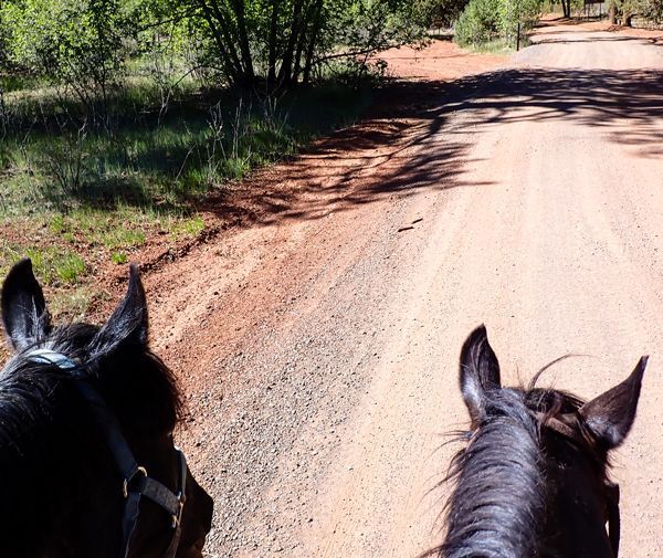
Almost two years ago, trees were marked for a forest thinning project in the vicinity of the Ice Cave Trail but it was late 2020 before I heard the growling buzz of logging machinery slicing through mature pine trees as if they were twigs. Horses and logging machinery should not mix so I avoided the thinning project on my rides. When the holidays interrupted the logging, I rode Cinnamon out to investigate.
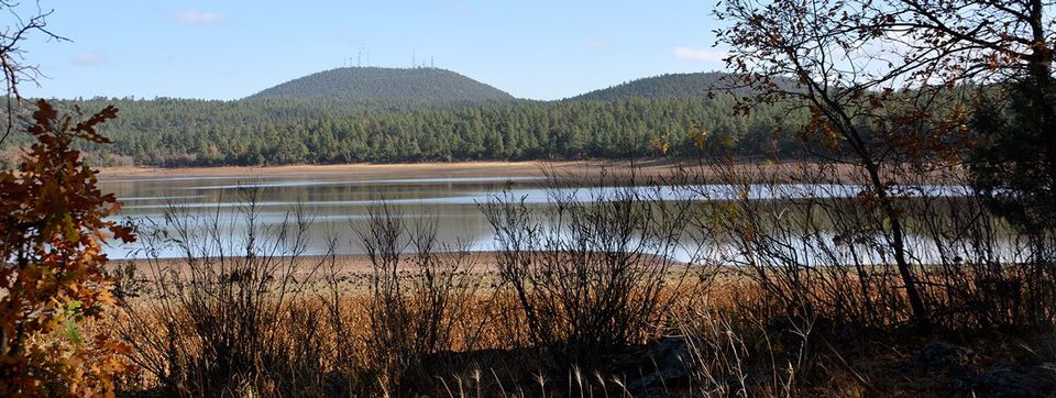
The Ice Cave Trailhead is at the southwest corner of the Scott Reservoir Recreation Area beside Porter Mountain Road. The parking lot is small but the Trail is popular. For the first half-mile or more, the Trail is straight -- almost flat and relatively smooth as it parallels the Forest Service boundary fence along a power line right-of-way. That changes between safety markers IC2 and IC3 when the Trail drops into Porter Creek Canyon.
In past years, Cinnamon and I have ridden to the Ice Cave on New Year’s Day when it was four degrees -- with six inches of snow -- and found the Cave with a gorgeous curtain of icicles. We’re starting 2021 with a drought so the afternoon of January 2nd was in the upper 40s and sunny with neither snow nor icicles. I saddled Cinnamon and we set off. When we arrived at the drop-off, I dismounted and led her down the short, steep, rocky slope into the Canyon. At the bottom, I mounted and we continued along the Trail.
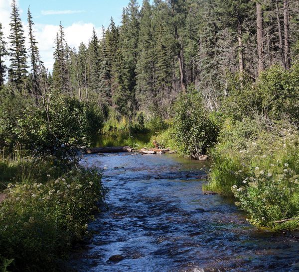
The TRACKS volunteers have recently added a culvert to the marshy area where water from a private pond seeps into Porter Creek. We crossed the culvert and followed the Trail up into the Forest. We met several groups of hikers enjoying the mild weather, including families with small children. Some groups had dogs, most of which were leashed. The Porter Mountain Riding Stable uses the Ice Cave Trail between the trailhead and marker IC2, and again between IC3 and the Ice Cave so this section of the Trail is easy to identify. Cinnamon carefully crossed the creek below the spillway for Scott Reservoir dam which does not have a culvert. We followed the Trail around the south shore of the lake where we met several more hikers.
After passing the hikers, I asked Cinnamon to running walk, she foxtrotted instead and we gaited up the slope, through the trees to the metal gate exiting the Recreation Area. This always gets Cinnamon puffing and snorting a little. The gate was standing open so we rode through and left it that way. We encountered several more hikers as the Trail wound through the trees. One woman asked if she was going toward the Reservoir and seemed relieved when I assured her she was.
The Ice Cave Trail looked just as it has for several years, though I still miss the picturesque, “horse eating” juniper tree snag that somebody poached a couple of years ago. Cinnamon was almost as alarmed by the disappearance of that snag as she had been by her first sighting of it 14 years ago.
We were in the vicinity of marker IC6 when we found the thinning. The Ice Cave Trail now has a corridor of trees beside it but there were piles of recently cut pines on both sides of the Trail and tracks from the logging machine on the ground. Cinnamon eyed these curiously.
The official route of the Ice Cave Trail bypasses the Cave, which is between markers IC9 and IC 10 but there is a well-worn Y junction and path to the Cave. For several years now, Trail users have been creating a tepee out of downed branches at this junction. I don’t know what their purpose is but it makes it easier to find the Cave even after the tepee collapsed. Cinnamon and I took the left side of the Y to loop around in front of the Cave and its surrounding fence. The gate was locked, as it should be.
The Ice Cave, also called the Blue Ridge Cave, is a hole in the ground formed by a lava tube. You can feel a draft of cool air coming out of it if you stand in just the right spot on a hot day. I’ve been told by people who have been inside it that the Cave has three rooms. The Forest Service put the fence around it in the early 1990s to keep people out. Some rocks broke loose from the entrance and fell into the hole a couple of years ago.
Cinnamon was disappointed when we turned left to continue toward the Blue Ridge Trail instead of going home. There was no sign of thinning in the vicinity of the Ice Cave but we found marks on the trees again around marker IC11 and more stacks of freshly cut trees between IC12 and IC13. We met several more hikers and their dogs for a total of at least eight different groups which is more typical for July than January. We also saw more people than usual beyond the Cave. From IC10 to the junction with Blue Ridge Trail -- a few feet beyond IC16 -- the Ice Cave Trail is narrow, rocky and climbs steadily.
Trail users have two official options from the junction. One is back tracking the full length of the Ice Cave Trail. The other is turning either right or left on the Blue Ridge Trail -- which is a 9-mile loop -- and following it to one of its two trailheads. If you know your way around that part of the Forest, there are ways to make a loop off of Blue Ridge Trail back to the Ice Cave Trail but, if you don’t, you might get lost. Cinnamon and I made a loop. We passed one of the Porter Mountain Stable rides near Scott Reservoir on our way home. Happy Trails in 2021!
From scenic overlooks to rivers and wildlife in the White Mountains
Horseback Riding the White Mountain Trail System

Opening home and heart to love again

Kayaks and Crawdads at Big Bear Lake (Sush Be Tou)

Great-Granddaughter of Corydon Cooley
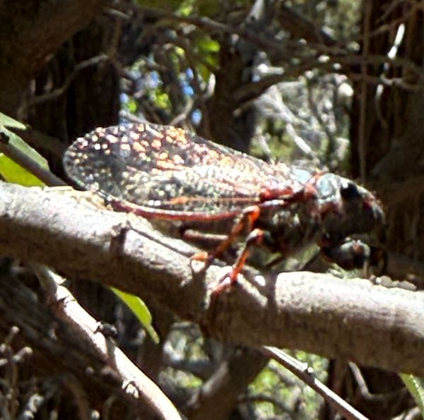
The plight of the cicada
Adventures in Costa Rica part II

The stories we tell ourselves color our responses...

Local White Mountain Artisan and Authur

Are you the voice in your head? or something deeper...