From horseback to hikers...
When my family and I moved back to the White Mountains in 1978, the Blue Ridge Trail was the one designated hiking trail in the Lakeside Ranger District of the Sitgreaves National Forest. A trail also existed near the Los Burros Campground. There were hundreds of miles of old logging roads, one-lane wood cutting tracks, ranch roads and trails that people used for work and recreation. These trails had no official status and a few of them crossed undeveloped private land. Unmarked routes that were on public land included well-established trails near Billy Creek, Woodland Lake and in Wagon Wheel, Linden and Pinedale.
The 1980s brought growth and increased organization to the region. I was a member of the Medical Emergency Response Team that created the Emergency Medical System for Lakeside Fire and Pinetop Fire Districts in February, 1983. The incorporation of the Town of Pinetop-Lakeside in 1984 brought street names, an organized physical address system, a Police Department, development of Woodland Lake Park and more. All of this benefitted residents and visitors but population growth and urbanization began to threaten the equestrian lifestyle that was part of the rural character of the area.
In January, 1987, I received notification that my horse was in violation of the zoning ordinance and given 30 days to move her. This was disconcerting because we had been told it was legal to keep a horse on that property and there were half a dozen other horses in the same subdivision. I went around to the Pinetop-Lakeside town offices to find out what the zoning issue was and to request an extension of the deadline for moving my horse. The extension was granted. I then began the search for a legal place for my horse to live.
Two of the people I talked to were Mary Ellen Bittorf, owner of the M Bar C Tack Shop -- which was across the street from the Lakeside Forest Service office -- and her employee Bev Garcia. I learned I wasn’t the only horse owner suddenly having problems with zoning and trail access. Mrs. Bittorf had kept a horse at her house in Pinetop and was involved with the Town government so she was aware of the conflicts. She gathered a list of names of concerned horse owners. I was one of the people who met in Navopache Electric Cooperative’s meeting room in their Lakeside office on February 23, 1987 to organize the White Mountain Horsemen’s Association (WMHA) for the purpose of protecting and promoting horsemanship and the equestrian lifestyle in the White Mountains. The WMHA’s founding board was comprised of: President Bev Garcia, Pinetop; Vice-president Ray Brown, Linden; Treasurer Ginny Handorf, Pinetop; Secretary Allanna Jackson, Lakeside and included Sam Campbell, Show Low; Jean Dillman, Clay Springs; Doug Rummens, Taylor; Warren and Cindy Smith, Lakeside and Jerry Handorf, Pinetop.
In April 1987, Jerry Handorf presented a Trail Systems Plan to the WMHA board and then to the general membership. The goal of that original plan was to establish and maintain a network of interconnected equestrian trails in and around the communities of Pinetop-Lakeside, Show Low, Wagon Wheel, Linden, Pinedale, Clay Springs, Taylor, Snowflake and Vernon. Specific objectives for Pinetop-Lakeside included establishing the Blue Ridge Trail as a designated equestrian trail with the US Forest Service, creating a network of hiking/equestrian trails throughout Pinetop-Lakeside and assisting the Town in formalizing the Woodland Lake Park trails. The plan’s general objectives outlined how the plan would be implemented. The WMHA’s original trail coordinators included: Nora Isaacs, Lakeside; Karen Maier, Vernon; Dale Ryan, Snowflake; Pat Hansford, Linden; Bev Garcia, Ray Brown, Allanna Jackson and Jean Dillman.
Jerry Handorf’s Trail Systems Plan was approved by the WMHA board and adopted by the members at the April, 1987 general meeting. The WMHA developed collaborative relationships with the US Forest Service, the Town of Pinetop-Lakeside, the City of Show Low, the Chambers of Commerce, the Arizona State Parks and Trails, the Arizona State Horsemen’s Association, the Apache County Horsemen’s Association and other groups. WMHA members provided the volunteer manpower to implement the Trail Plan. The vision included urban trails within the incorporated areas but obtaining rights-of-way proved to be so difficult that the White Mountain Trail System is still almost entirely on National Forest land.
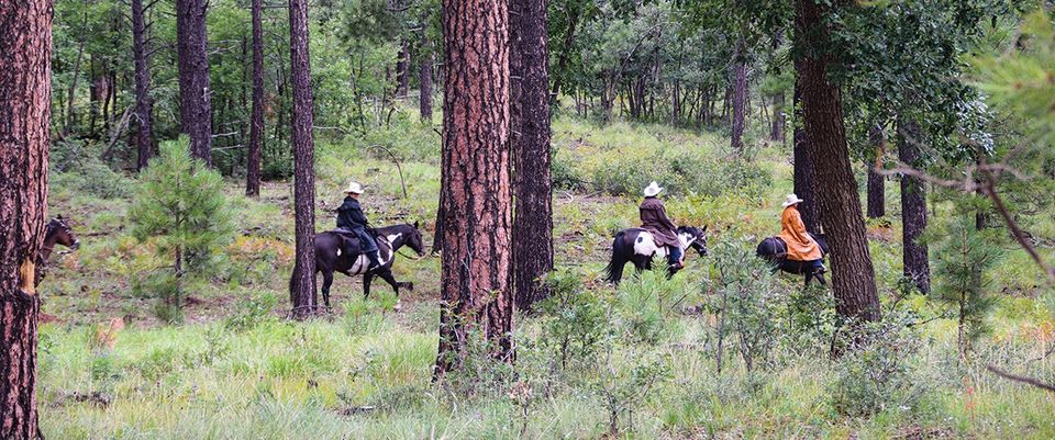
By May, 1987, the WMHA had a roster of 60 people, advertisers and business sponsors. The WMHA’s monthly general meetings were held at what was then the Paint Pony Lodge Restaurant in Show Low in the building that now houses Licano’s Mexican Restaurant. The group took a proactive and ambitious multi-pronged team approach to addressing their concerns. WMHA representatives negotiated with the municipal governments to modify zoning ordinances in ways that balanced the established horse-related land uses with the needs and concerns of horse-less neighbors. The WHMA put a group of riders with a color guard in all of the local parades and sponsored group trail rides, educational clinics, a play day and a fun show -- in addition to developing the Trail System.
WHMA’s group rides included the Mount Baldy Trail in the Mount Baldy Wilderness as well as proposed routes for the Land of Pioneers, Juniper Ridge and parts of what became the Ghost of Coyote and Four Springs Connector Trails. None of these trails match the exact routes the WMHA riders took in the summers of 1987 and 1988. Many of the trails in the White Mountain Trail System have been re-routed multiple times or re-built entirely for a variety of reasons that include: logging projects, improved access, erosion control, motorized traffic control and wildfire damage. The Land of Pioneers Trail was damaged by a logging project and re-routed within a year after it was created. The original Ice Cave Trail followed a completely different route in 2002. The Rodeo-Chediski wildfire destroyed much of the tall Ponderosa pine forest between Linden and Overgaard which drastically changed all of the trails west of Show Low.
As soon as the weather permitted in the spring of 1987, with approval and guidance from Bill Caskey and other US Forest Service employees at the Lakeside office, WMHA members began flagging proposed trail routes. The flagging was done with two colors of plastic ribbon, white and lime, supplied by the Forest Service. This color scheme proved to be hard to see against the foliage but the biggest problem was elk eating the ribbons. We were advised to use the remnants of logging and woodcutting roads as much as possible to expedite the approval process because these uses had already impacted the environment and logging projects had been subjected to the requisite studies. This enabled the Forest Service to approve the new trails very quickly. Guidelines about trail construction evolved over time -- based on local experience -- as the Trail System developed.
Ms. Pam Gilmore, the Pinetop-Lakeside Parks and Recreation Director, organized the Pinetop-Lakeside Trail-A-Thons, held at Woodland Lake Park on National Trails Day in June, 1988, 1989 and 1990, to promote the Town of Pinetop-Lakeside, Woodland Lake Park and the new White Mountain Trail System.
Between 1987 and 1989, WMHA members created the Land of the Pioneers, Juniper Ridge, Ghost of Coyote, Los Caballos, Ice Cave, Springs and Country Club Trails. The Country Club Trail exposed the need for short extensions off a main trail to an overlook or other point of interest. The Blue Ridge Trail was re-routed. The Los Burros, Woodland Lake Park and Billy Creek Connector Trails became designated non-motorized trails. The Timber Mesa, Panorama and Buena Vista Trails were scouted and flagged. My proposed route for a trail along the bluff above the east side of Scott Reservoir was previewed by the Forest Service but not approved. The Osprey Connector Trail that was later built and named by T.R.A.C.K.S. uses my proposed route between Porter Mountain Road and the new Ice Cave Trail. At one of the WMHA general meetings, Pat Hansford reported on her communication with the Arizona Department of Transportation about obtaining permission to use the concrete culvert under Highway 60 as a tunnel for the Chihuahua Pines Connector Trail. Scouting of other connector routes began.
As the White Mountain Trail System took shape on the ground and people began using the trails, the WMHA realized several of the new trails were too long for most hikers. The solution was to develop shorter loops within the longest loop trails. These short cut trails would divide the longest trails into thirds, with the shortest loops being no more than five miles and the intermediate loops being around eight miles for loop trails that were longer than ten miles.
The trail marking system that the WMHA and the Forest Service agreed on was plastic diamonds in a distinctive shade of turquoise blue with the trail number or directional arrows printed in black. Then, as now, yellow dots on the diamond signified a short cut trail; red dots on the diamond signified a vista or overlook trail and green dots signified a connector trail linking two of the main loop trails. Many of the turquoise diamonds were vandalized or became so badly weathered, the T.R.A.C.K.S. organization replaced them with blue diamonds before the whole White Mountain Trail System was converted to the current safety coded reflective white diamonds. A few fire-melted and orphaned turquoise and blue diamonds can still be found as sentinels of original or abandoned trail routes.
By 1990, all of the major loop trails proposed in the WMHA Trail Systems Plan were complete and many of the connector trails were under development. In the early 1990s, several WMHA founders experienced life-changing circumstances and Sam Campbell died. New members and new leadership shifted the WMHA’s focus to other interpretations of its multi-purpose mission. In 2002, WMHA members assisted with the evacuation of livestock from the Rodeo-Chediski Fire. I was the last WMHA founder to let my membership in that organization lapse.
The T.R.A.C.K.S. organization originated in 1990 as an ad hoc committee of the Town of Pinetop-Lakeside with the sole purpose of developing, maintaining and improving the White Mountain Trail System. T.R.A.C.K.S. became a 501(c)(3) non-profit corporation in 2013 and has maintained and expanded the partnerships that support trails as it continues the ongoing task of managing the White Mountain Trail System. T.R.A.C.K.S. reports that it now has 350 volunteers working on the trails. For current trail maps and information about the White Mountain Trail System, visit the web site: https://www.trackswhitemountains.org or the US Forest Service office in Lakeside, AZ.
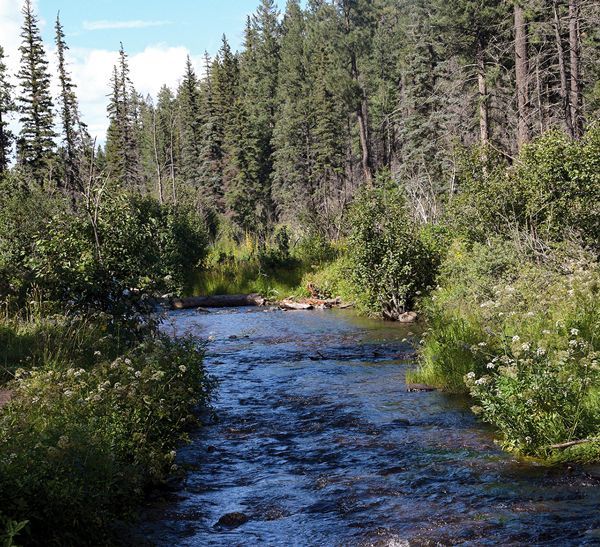
From scenic overlooks to rivers and wildlife in the White Mountains
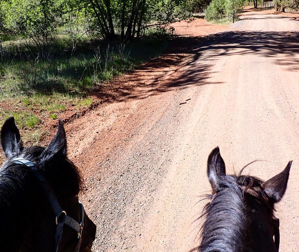
Horseback Riding the White Mountain Trail System

Opening home and heart to love again

Kayaks and Crawdads at Big Bear Lake (Sush Be Tou)
Great-Granddaughter of Corydon Cooley
The plight of the cicada

Adventures in Costa Rica part II

The stories we tell ourselves color our responses...

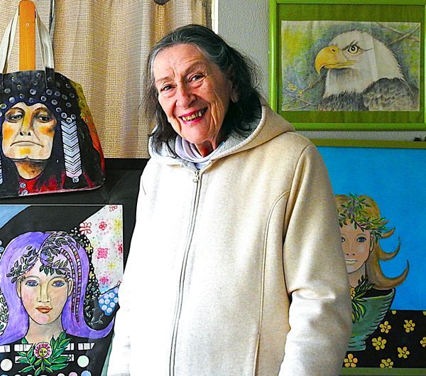
Local White Mountain Artisan and Authur

Are you the voice in your head? or something deeper...