Juniper Ridge: Short Loop
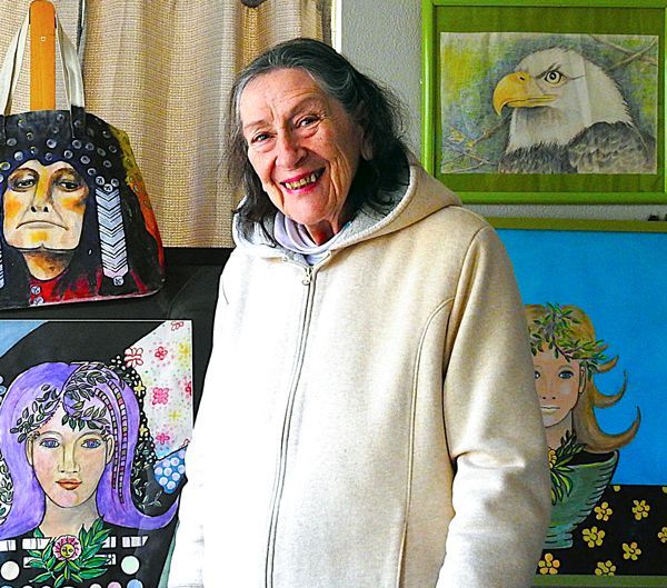
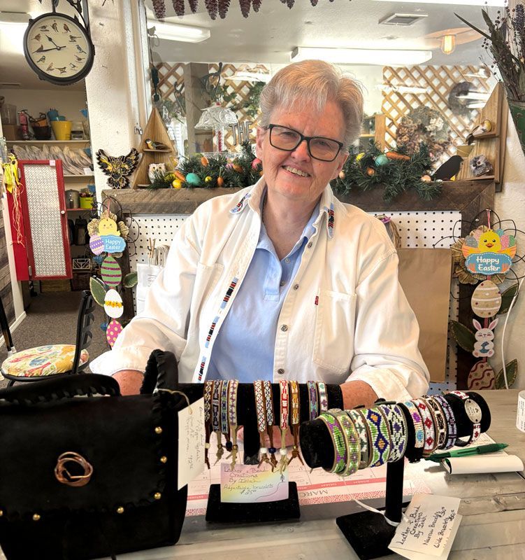
Photos & text by Allanna Jackson
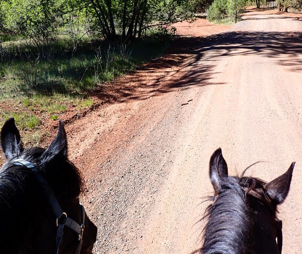
Friday, December 29, 2023 was unseasonably warm and sunny with a light breeze. Perfect weather for a trail ride. I trailered Cinnamon to the Juniper Ridge trailhead beside Farnsworth Ranch Road. The western trails in the White Mountain Trail System have sandy soil and direct sunlight so they dry out faster than the central and eastern trails.
Someone else had the same idea. A truck and horse trailer were parked at the trailhead when I arrived just as a pair of riders were returning. Three domestic horses watched each other curiously. We humans said a brief hello and returned our attention to our horses. While they prepared for their trip home, I saddled Cinnamon for my ride.
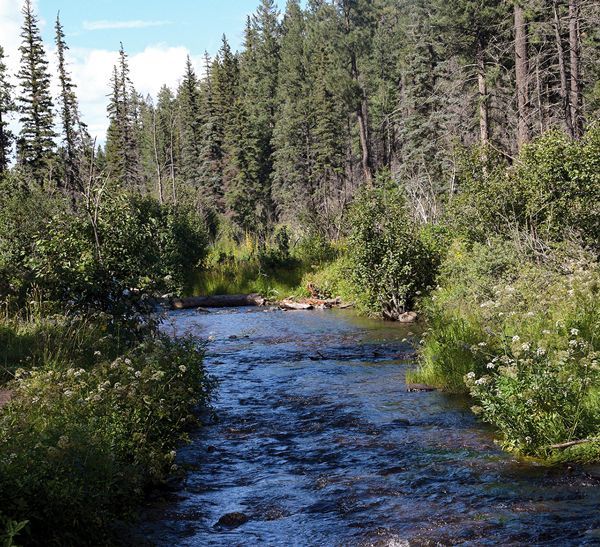
Cinnamon was a little sluggish and worried starting out. I couldn’t tell why. She’s been out here before. It’s about three-quarters of a mile from this trailhead to the loop trail. The ecological mosaic left by the Rodeo-Chediski fire is evident here. The trailhead is shaded by Ponderosa Pines that survived the fire but leaving the parking area, the trail immediately enters a burn scar that has recovered with oaks, junipers, manzanita, and a few new pines. The trail angles down into, across, and out of a small wash which has Ponderosa on its banks. The trail crosses a road to the fence corner where the Forest land abuts private property just before the J2 (J)uniper Ridge white diamond trail marker. It follows the fence through another patch of undamaged pines for about a quarter mile before meeting the loop portion of the trail just before J4 marker.
At the junction we turned right at a sign to Lewis Canyon Campground. The trail is quite sandy as it goes through a pine-shaded meadow to Pinedale Road/Forest Road (FR) 130 opposite the entrance to Lewis Canyon Campground. There was a traffic barricade and “road closed” sign across the campground road with a smaller hand-lettered sign saying the outhouses were closed. Trail markers J5 and J6 are on the campground road going to the Juniper Ridge/General Crook Connector Trailhead at the southwestern corner of the campground. Cinnamon perked up and relaxed when we turned left toward the J7 marker after passing General Crook Connector marker GC1 on the right.
From J7 to J9 the trail wanders across hills that reveal the erratic nature of wildfire. Climbing up the hill from J7 to J8 is undamaged ponderosa pine forest. The hills between J8 and J9 burned and have recovered as oak, juniper, and manzanita, with a few young pine trees growing between the fallen remnants of their ancestors. After paralleling FR 130 for half a mile or so the trail enters another patch of undamaged Pines at J9, turns left, crosses FR 130 again and goes through more pines before emerging into a meadow at J10.
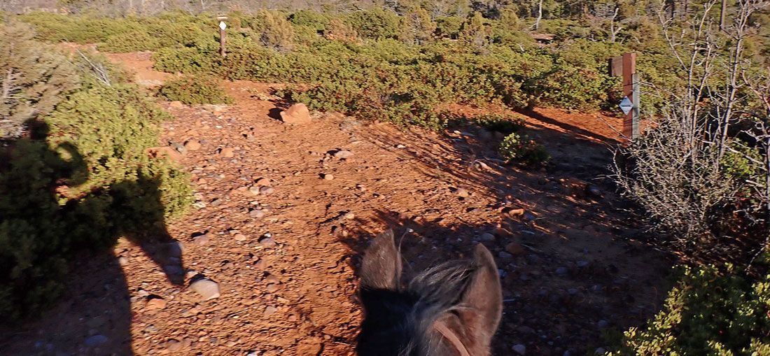
The trail follows a little power line briefly before abruptly turning left to cross Mortenson Wash. Cinnamon slowed to carefully navigate the tricky footing of the round, smooth, hoof-sized, river rocks. She paused at the edge of the deepest spot of the wash and inspected the route up to J11. The wash was dry. After studying the situation Cinnamon continued confidently across and up the hill to the horse gate near J12.
When we reached the gate Cinnamon poked it with her nose, but it had fallen off its hinges so she couldn’t help me with it. I dismounted and lifted, dragged, and pushed the gate open, then led Cinnamon through. She very neatly stepped over the bottom bar and stood groundtied perfectly while I pushed and dragged the gate closed. That’s when I discovered I’d failed to bring horse cookies. Cinnamon gave me a reproachful look as I praised her and mounted.
From the gate we climbed the hill up to J13. I consider this the most interesting portion of the short loop. The bright green manzanita leaves made a beautiful contrast with the orange-red rocks of the hill. Cinnamon huffed and puffed her way to the top.
Between J13 and J14 the trail follows the shoulder of the ridge with panoramic views of the surrounding canyons with hills on three sides. We followed the trail as it began its descent to J14 where the Short Cut Trail turns left to J50 and the main trail turns right to J15.
The Juniper Ridge Short Cut is about a mile long, counting down from J50 to J47, before converging with the main trail again at J43. The Short Cut can’t decide whether it’s a trail, a water course, or a meander through the manzanita. The route crosses a couple of hills and washes that are covered with manzanita and oak before climbing up into another undamaged patch of Ponderosa Pines before rejoining the main trail. We turned left at a sign that directed us to the “trailhead."
Between J43 and J44 Cinnamon abruptly stopped and stood at full alert as a herd of four or five horses trotted and loped across the trail in front of us on a well-worn path of their own. Part way up the slope to our right they stopped to stare at us staring at them. One of them blew loudly — the equine “Danger!” signal. Cinnamon stood silently, unperturbed by their warning.
Sighting these free-roaming horses turned my thoughts to the emotionally charged, ecological, political, and economic conundrums and absurdities we humans have created for ourselves with our categorizations, demonizations, idolizations, and mythologizing about horses. Cinnamon is a registered horse. Breeds have been developed for specific traits so registration does add value, but many domestic horses are not registered and domesticated mustangs make excellent trail horses. What is the difference between domestic, wild, feral, unauthorized, wanted, and unwanted horses except the circumstances of their birth and management? The lives of all of the horses at marker J43 on Dec 29 were influenced by the Rodeo-Chediski Fire 21 years ago. The herd staring at Cinnamon, and the other free-roaming horses in Pinedale, Linden, and Show Low, are undoubtedly descendants of horses that were displaced by the fire. Twenty miles away, in Lakeside, Cinnamon was only 5 weeks old when she had her first trailer ride to evacuate from the fire.
Cinnamon and I continued down the trail through a steep but small wash near J44 to the next gate. This gate was in good condition so Cinnamon happily helped me open and close it, and again let me know she was disappointed I’d forgotten her cookies. She picked her way carefully across Mortenson Wash again and we followed the little powerline back to J46 where we met marker J3 along the private property fence and backtracked our way to the trailhead in time to make it home before dark.
To reach the Juniper Ridge Trailhead off of Farnsworth Road, from Show Low take AZ State Route 260 towarad Heber-Overgaard, drive 9.9 miles until you reach Farnsworth Road (Old Highway 160) on the left. Follow Farnsworth Road two miles until you reach the Juniper Ridge Trailhead.