Sacred Mount Taylor: Turquoise Mountain or Blue Bead Mountain
Photos and article
by Anne Groebner
One thing I can always count on is my brother, Jeff, telling me about the most recent book he is reading. Since he’s a biologist and a linguist, I trust his judgment, and I usually buy the book or he will, sometimes, send me his copy when he finishes reading it. When he told me about the book “Talking To The Ground,” by Douglas Preston, I knew I had to read it. I didn’t wait for him to finish. I ordered it. It’s about crossing the Navajo Nation on horseback. Preston, spurred on by his reading of the Navajo Creation Story, took his fiancée (at the time) and her daughter and they rode horseback through history, culture and mythological topography, across the Diné Bikéyah — “People’s Land” or “Navajoland.” Throughout the book, Preston provides many historical facts and personal experiences to enlighten the reader. Learning about the cultural and spiritual history of these mountains and the land, makes the journey of experiencing them so much more inspiring. So, after months of planning, I grabbed my friend (and writer) Rob Bettaso (who also read the book) and we headed for New Mexico to climb Mount Taylor.
There are four sacred mountains that mark the boundaries of Diné Bikéyah; Sierra Blanca (in southeast Colorado), Mount Taylor (in northwest New Mexico), The San Francisco Peaks (in Flagstaff, Arizona), and Hesperus Peak (in southwest Colorado). Mount Taylor marks the southern border of the “Dinetah,” the traditional Navajo homeland, and is only a few hours away from Pinetop. The Navajo’s call it Tsoodzil (Blue Bead Mountain or Turquoise Mountain) — its color is blue and its gender, female. According to their mythology, “First Man created the sacred mountains from the Fourth World, together with sacred matter, as relics of mountains from that world. He fastened Mount Taylor to the earth with a stone knife.” It is said that Black God, Turquoise Boy, and Turquoise Girl still reside on the mountain.
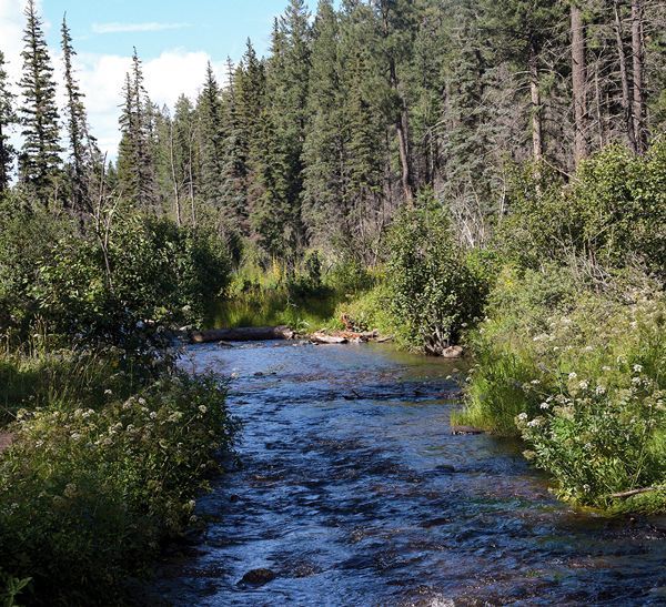
Mount Taylor sits in the Cibola National Forest and stands as the highest point not only of the San Mateo Mountains but also of the entire Cibola Forest. It is a prominent (dormant) volcano that is part of the Mount Taylor volcanic field. Its vast height makes it visible for hundreds of miles. While in route to the Gooseberry trailhead, where we began our climb, we could see it peek through trees in its grand stature. Meadows cover most of the peak, giving it a bald appearance, but lower elevations, as we soon discovered, have a dense forest of Pinon juniper at lower elevations, then ponderosa pine, Engelmann Spruce, Douglas fir, and aspen.
After parking at the trailhead, we started getting our packs ready, stuffing them with plenty of water and snacks. Duncan waited patiently behind the truck while we worked to get ready. To our surprise, a small cinnamon bear scrambled down the tree we parked next to. I put Duncan, who never saw the bear, back in the truck, then tried to get a picture of the bear as he scurried away, but all I got were aspen trees. They were beautiful, but not as exciting as a picture of a bear. I believe seeing a bear in the forest can be a powerful and symbolic experience, as bears are often associated with strength, power, and primal instincts, but they can also be the potential for danger and unpredictability. After surmising why a bear would be up a tree next to multiple cars in a parking lot, we put on our packs, leashed up Duncan and headed up the trail.
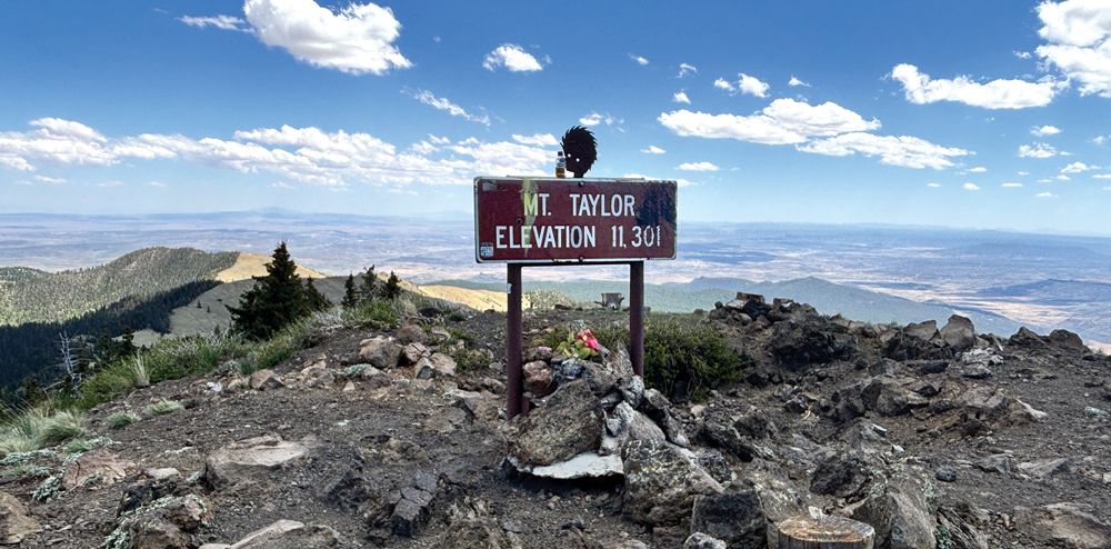
The first part of the trail is unremarkable, and I say that in the most respectful way. Looking back now as I’m writing this, I would have to say that the first mile (at 9,500 feet) wasn’t as spectacular as the higher elevations. In fact, the more we ascended the mountain, the more remarkable it became — with the climax being at 11,308 feet. Every level transformed into something incredible. Different trees and unique landscapes unveiled extraordinary views. At one point, I turned around to tell Rob something and literally gasped at the view behind him. I didn’t expect to see the entire valley below.
Leaving the dense forest and entering the meadow, the sun was stronger through less atmosphere and I worried about my black dog, who would scramble for shade at any chance he could. Rob felt the ground and said it was pretty cool, but a black dog in any sun is a problem. Luckily, I had brought a white t-shirt with me, so I soaked it with water and tied it around him and it worked perfectly.
As we neared the peak, the climb got a little steeper in some places and every time we thought we were there, another switchback showed its face. Slow and steady was my motto. After getting a pacemaker last year, I needed to monitor the beats of my heart (that were playing loudly in my head). However, my Apple Watch, that saved me in the first place, never buzzed or dinged, so I knew I was good to reach the top. And I did — and it was great. It was well worth the wait, the planning and the pain — and I would do it again — except now I have my sights on another peak.
Hiking down a mountain is pretty hard on the toes and my feet were pretty sore by the time I got to the bottom. Duncan knew we were heading for the truck and I had to reel him in occasionally, while hopping from rock to rock along the trail. We met some very large cows grazing the meadow and Duncan thought he could take them on, but I convinced him to keep moving forward.
According to Rob’s GPS, the actual height of the mountain is 11,308 feet and the length of the trail is just under 3.5 miles one way, with a 2000’ climb in elevation — for a total of about 7 miles. We started hiking at 11:21 a.m., got to the top by 3:00 p.m. and got back to the truck by 5:00 p.m. From the trailhead, it’s about 3.5 hours back to Pinetop and we made it by 8:30 p.m. Two Tylenol and early to bed, and I was ready to go the next day. It’s great to be back on the trail and my old self again.